Why do we need such a tool?
There is a couple of good reasons.
First, IL-2 maps are typically HUGE in comparison to ARMA maps. Most ARMA maps are 5x5 km, or 10x10 km. Most IL-2 maps are hundreds of kilometres square and since SEOW actively campaigns across IL-2 maps, if we want to examine the combat outcomes in detail we need a way of focusing locally but consistent with the broader context. One SEOW campaign on an IL-2 map can, in principle, generate hundreds of unique ARMA terrains with many different mission scenarios on each terrain.
Second, the range of stock ARMA maps is VERY limited. These maps are built by very dedicated and talented designers and the results are intricate and spectacular. But the available map editing tools are awful, so to have a summary tool like DMT that can hide most of the gory details from us is a good thing. As a simple computer script, DMT will never achieve the same artistic results as lovingly hand-made maps produced by human designers over weeks and months of labour, but it does produce convincing terrains populated with vegetation, topography, roads and buildings in just a few minutes. The feedback from beta testers is that DMT terrains are more than adequate environments for engaging scenarios in ARMA2 and Iron Front.
What is DMT?
DMT is a PHP script that is integrated into the SEOW Mission Planner (MP). The integration is loose at this stage, so it would be possible to extract it from the MP and run it stand-alone without too much work. DMT depends on some external software tools:
ImageMagick Binaries - for bitmap programming support
IL-2 Map Expansion Tools - IL-2 community-contributed tools for expanding compiled IL-2 maps into component files
GD2 Library - part of PHP
BIS Editing Tools - including object folders etc (see https://community.bistudio.com/wiki/Arm ... n_Tutorial for an introduction) - and here is a great piece of advice: throw away the BIS Tools (except Visitor3) and use mikero tools instead. The prime weakness in BIS Tools is BinPBO; the mikero counterpart is pboProject.
In order to extract data from an IL-2 map, the map must first be expanded using the IL-2 community tools. This forms a database that can be used repeatedly by DMT to extract the specific geographic data for each required ARMA2 map.
How does DMT run?
DMT is called through a web browser. It must be supplied with arguments via standard HTTP GET syntax, for example
Code: Select all
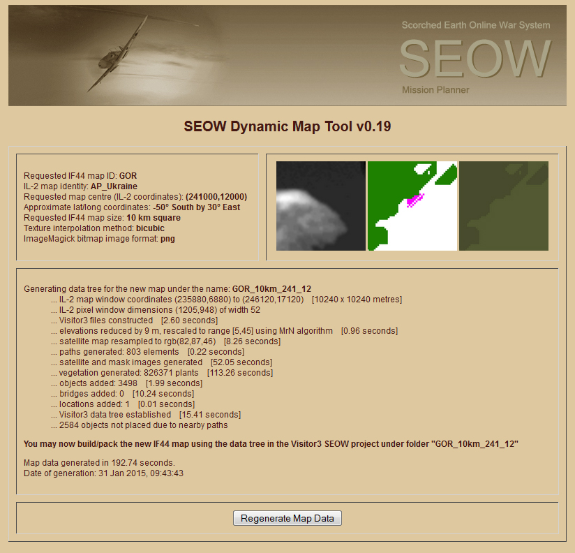
http://localhost/SEOW/MP4public/DMT/default.php?Map=AP_Ukraine&ID=GOR&X=241&Y=12&Size=10km&Format=png
This is a large map for ARMA (100 square kilometres) and it took DMT about 192 seconds to extract and format the required IL-2 data to build the new GOR terrain. DMT processes smaller maps, e.g. 25 square kilometres, in about 30-40 seconds. To actually create the ARMA2 map using DMT output files is quite simple, requiring the use of Visitor3 and pboProject, and takes less than 15 minutes for the above GOR terrain once DMT is finished. These tools are part of the standard map editing suite for ARMA.
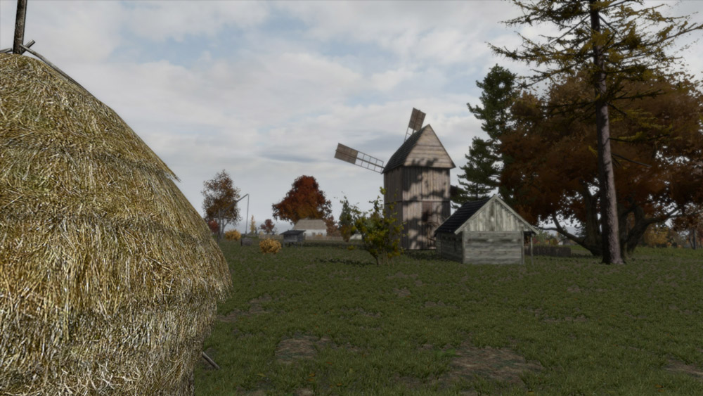
The nice thing about DMT is that it reads IL-2 data structures, extracts the relevant information, and formats it into ARMA data structures, supplying ground clutter definitions, forests, urban areas, buildings, roads etc, so the ARMA map looks like (well, similar anyway) what you would see on the ground in the IL-2 Full Mission Builder.
Example Maps
Here are some example maps that can be downloaded and play-tested in ARMA2 or Iron Front (using the PWS Mod), including the GOR example above. These are maps only - no mission files are included. Before downloading the zip files, go to your ARMA2 folder (or A2OA folder) and create a new folder called @SEOW. Inside @SEOW create another folder called AddOns. Download the zip files into @SEOW/Addons and unzip them there, making .pbo files. Start your ARMA2 or A2OA games, enable the @SEOW expansion and look at the maps in the Editor.
Dabryn - map "DAB_5km_37_121" (isolated village near road intersection)
Gorodishche - map "GOR_10km_241_12" (large village on flat terrain near vast forest)
Vakhanovka - map "VAK_5km_33_23" (farming hamlet, crop fields, large hill to south)
I am aware of various issues that need to be improved in subsequent DMT updates:
*) the full 16-bit resolution of the terrain elevation map is not being used, resulting in "terraces" on some hillsides - fixed
*) some trees are too close to houses
*) road junctions need to be handled better
*) Iron Front objects (houses etc) should be used to give a more authentic WW2 look - fixed
*) no provision yet for rivers, coasts
*) cities not yet supported - I have been focusing on rural areas, villages, hamlets etc. City building mappings need to be added, and perhaps some new clutter types
Summary
This page shows that DMT is now working and capable of producing ARMA2 terrains rapidly, using IL-2 maps as a reference. The three examples here were built from the AP_Ukraine map of IL-2, which is 288 k by 201 km in size and land-locked. Many, many more ARMA2 terrains are possible from AP_Ukraine simply by dialling in the desired centre coordinates to DMT. And, apart from AP_Ukraine, we have over 100 IL-2 maps that we can potentially play with...
Enjoy!


